Disclosure: This post may contain affiliate links. I earn a small commission of product sales to keep this website going.
I must have been pretty tired yesterday! Waking up early for a short hike and driving all day…I didn’t think it’d take that much out of me. I slept surprisingly well for just reclining in my driver’s seat and throwing a sleeping bag over me. To my disbelief, I didn’t even wake up when the Volvo wagon parked right behind me at some point during the night.
Mendocino was only a short drive away so I warmed up the car and was on my way. It was another cold, foggy morning, so all I did in Mendocino was grab a cup of coffee when the café opened. Fort Bragg weather was more or less the same; I stopped for a little bit at Glass Beach to exercise the legs and started thinking about my next move.
To Avenue of the Giants
The Lost Coast Trail is one of my most favorite trails in the world. Three days along the most rugged coastline in California, timing the tides just right so you can make it past certain sections of the beach without getting swept away by the rising tide. The PCH was forced inland because engineers couldn’t even figure out a way to put a road through there. I love it!
I haven’t been on the Lost Coast since they started implementing a permit-only system in 2017 to combat the increasing number of hikers like myself. Since I was further north along the coast than I was expecting by this time, I thought it’d be a nice little detour to do an out-and-back from Mattole Beach for a night or two. It was too late to arrange for shuttle service but I could park at the trailhead, hike south as far as I could, camp on the beach, and make the return hike the next day. It’s mid-week in April and the weather is less than stellar so there has to be at least one permit available. That wasn’t the case after contacting the ranger’s office; the earliest permit for one wasn’t until next week. It’s getting to be a popular trail! Option B was to continue to Redwood National Park.
One section of US101 that I’ve never done before was the Avenue of the Giants, a 31-mile detour that parallels US101 in Humboldt County and meanders through dark, majestic redwood groves. The road has a number of pullouts and parking areas with hiking trails and informational signs that are very educational about the ecosystem and local history. This stretch of road is home to, literally, the tallest trees in the world and the largest stands of old-growth redwood trees in the country. It is part of Humboldt Redwoods State Park.
I was starting to fall in love with these trees. I’ve only ever driven past them and was always “on a schedule” every other time I’ve made this stretch of US101. I couldn’t wait to get to Redwood National Park.
Redwood National & State Park
I’ve never been to this park before and didn’t really do any advance planning as to where I would hike or camp. The staff at the Kuchel Visitor Center were more than helpful. I told them I had two nights, wanted to see different areas of the park, and would prefer to hike into backpacking campsites. They helped me come up with an itinerary that sounded great and would work well considering I wouldn’t get a start until the afternoon.
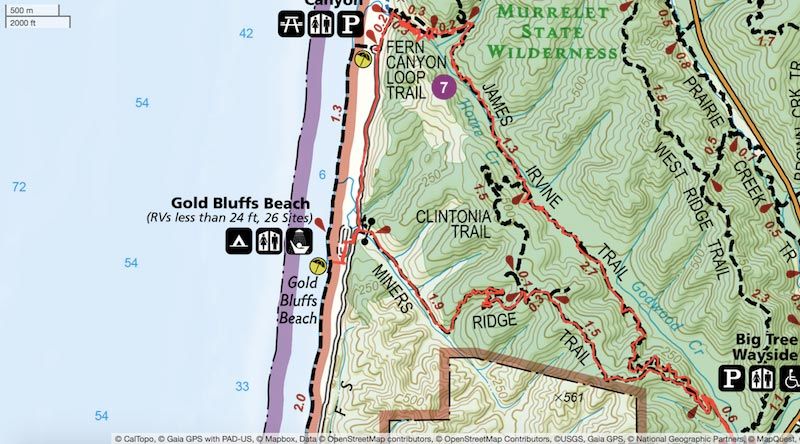
Today I’d hike Miner’s Ridge to Gold Bluffs Beach and camp at the hiker & biker camp. Tomorrow I’d go through Fern Canyon and return to my car via the James Irvine Trail. From there I’d drive up to the Tall Trees Grove parking area and hike down to Redwood Creek and camp on the gravel bar of the creek. The morning of the third day I’d go through the impressive Tall Trees Grove before returning to my car. Sounds like a fun few cheap days for me!

Days One and Two at Redwood National Park
Miner’s Ridge Hike to Gold Bluffs Beach Campsite
The Miner’s Ridge Trail is the most direct hiking route to Gold Bluffs Beach. This approximately 4.3-mile trail starts at the Prairie Creek Visitors center and the first mile climbs 500′ into the redwoods. From there the trail gradually descends to Gold Bluffs Beach. I didn’t leave the trailhead until just after 4 pm and arrived right around 6 pm.
I was in awe throughout the entire hike. The trees are just massive. And then you start thinking about the significance of this park. These are the tallest trees on Earth, some of the oldest, and they only grow in this tiny little section of northern California. The tallest are almost 400 feet tall and the oldest are over 2,000 years old. They were almost chopped to extinction because we’re greedy. It really is sad to think of what this area would be like without them…but then again, if they were gone, we wouldn’t have any reference to be sad about. The entire trail just looks fake. I’m not into fairy tales, but that’s the phrase I’d use to describe this place. The pictures don’t do it justice.
The late afternoon sun made its way onto the forest floor every now and then, shining through the fog and throwing shafts of light everywhere. Once I crossed the ridge and started descending closer to the ocean, I found myself in more and more fog. By the time I got to the beach, the entire coast was covered in fog.
Gold Bluffs Beach has a really nice campsite and is mostly used by car campers. The small area set aside for us outcast backpackers and bicyclists is south of the main campground. I was hoping to see the sun tonight, but as they say, make the best of what you have. I walked the dunes, made dinner, and chatted with the other backpackers for a little while.
There’s a lot of mining history at Gold Bluffs Beach also. As the name implies, gold was extracted from the cliffs along the dunes. Some rather ingenious methods were devised. There are no more signs of the mining camp.
I set up my tent next to some trees, between the ocean and the cliffs above. The sound of the waves echoed off of the cliffs all night long, giving me the impression I was surrounded by the ocean. Nothing puts me to sleep faster!
Photographing the Redwoods
I ended up mainly using the Fujifilm 14mm f/2.8 lens I rented from BorrowLenses.com. There’s just so much to photograph here, from big to small. But today I wanted to focus on the big, and the only way to capture that is with something like a 14mm lens, equivalent to 21mm on the Fujifilm X-T1.

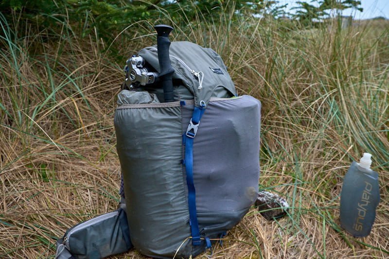
The MeFoto RoadTrip tripod fits nicely under my backpack flap
I kept my new MeFoto RoadTrip tripod tucked under the top flap of my backpack despite the darker conditions in the forest. Tripod or No Tripod is a discussion I have a lot with landscape photographers, so here’s my rationale for keeping it packed up on this hike:
- Camera shake is less apparent in wide angle lenses
- I could knock the aperture up to f/2.8 on this lens if I needed to
- The X-T1 does surprisingly well up to its native ISO limit of 1600 – which I didn’t even need here
- I like to move around in all directions, but I feel like I’m somewhat pinned down when using a tripod
- And, primarily, the wind was blowing things around so I had to keep the shutter fast anyways
I kept a slim digital polarizer in front of the lens to reduce glare on the foliage, enhancing the greens and the reds.
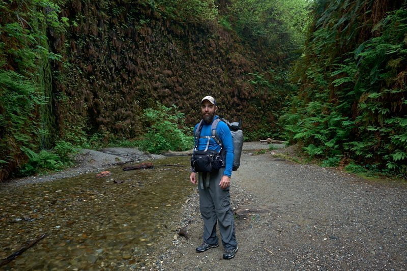
On previous hikes for this trip, I was using my Think Tank Speed Demon bag as a shoulder bag. Today, because I had my backpacking pack, I was wearing it as a hip bag. I still kept the adequately-padded shoulder strap tight to keep the bag from bouncing around. Here’s a lovely modeling photo from the future (tomorrow in Fern Canyon).

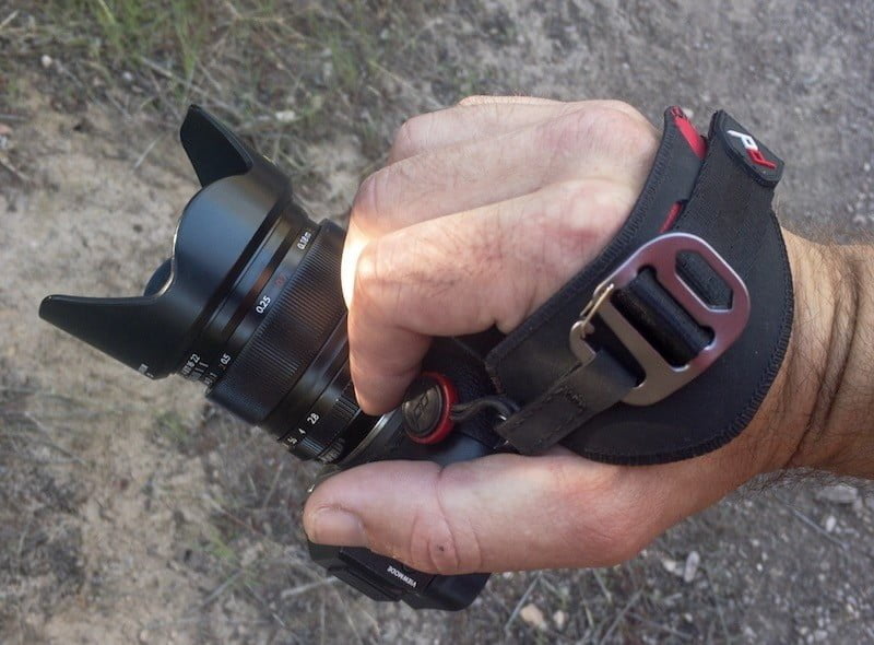
Go ahead and make fun of me for wearing a fanny pack. I’ve said it before and I’ll say it again – the only way to guarantee I’m actually taking pictures is to have the camera, lenses, and flash quickly available. A bag like this is an ideal camera bag for backpacking. In fact, I ended up just holding the camera for the entire hike using my new favorite accessory, the Peak Design Hand Clutch. The X-T1 with 14mm lens is featherweight in the hand.


Craig D.
Sunday 27th of May 2018
I agree on the pd handstrap. Love mine.
John Peltier
Monday 28th of May 2018
Oh cool! Yeah I've been using it much more than my shoulder strap lately.